Virtual Tour
PRESERVING THE PAST FOR THE FUTURE
OLD TOWN MAIN STREET
Kaysville Main Street Walking Tour
100 North to 33 South
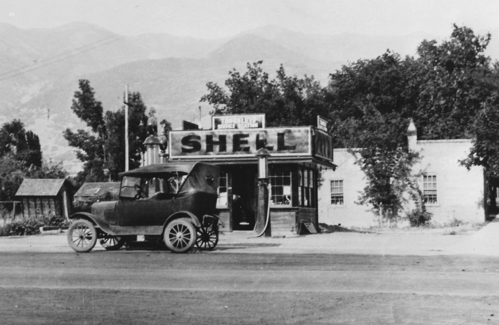 To walk its old streets is to feel the personality of Kaysville City.
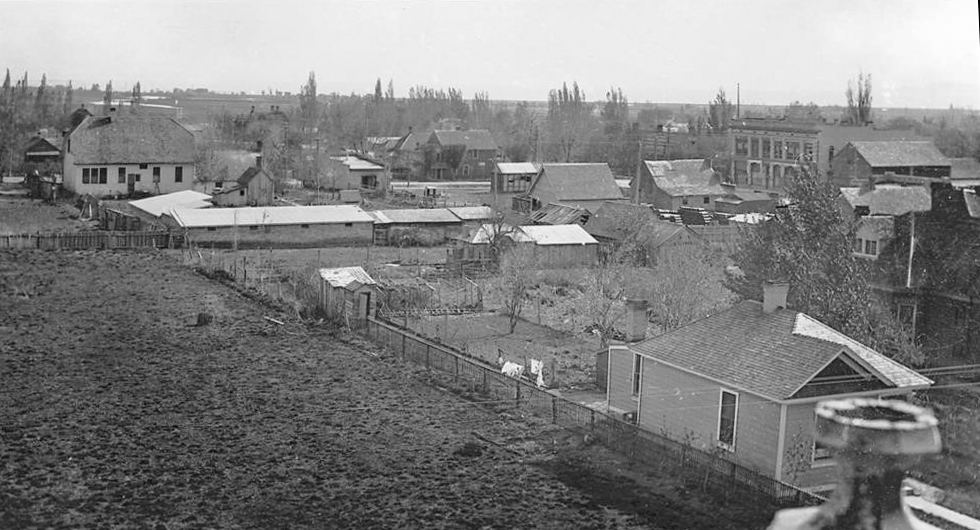
Why not get up, get out and walk today? Kaysville’s Main Street first appeared about 1854 as the State Road. It, along with the Mountain Road, became main thoroughfares connecting neighboring towns of the county. Kaysville was the first incorporated town in Davis County and settled primarily by English pioneers beginning in 1850. Of the first 29 families to move here, some of the others originated in New York, Vermont, and Kentucky (Preece). This portion of the Main Street tour (part 3) covers the southern half of the east side of Main Street in the historic center of town and is designed to be walked. A fun fact to note is that the odd and even number arrangement reverses at Center Street with odd numbers on the west side to the north and even numbers to the south.
1850 Main Street
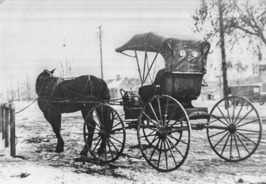 Kaysville’s Main Street first appeared about 1854 as the State Road. It, along with the Mountain Road, became main thorough fares connecting neighboring towns of the county. Kaysville was the first incorporated town in Davis County and settled primarily by English pioneers beginning in 1850. Of the first 29 families to move here, some of the others originated in New York, Vermont, and Kentucky (Preece). Part 1 of the Main Street tour covers the two-block length of the historic center of town and is designed to be walked. Part 2 will be a driving tour of the northern commercial avenue of the town. A fun fact to note is that the odd and even
number arrangement reverses at Center Street with odd numbers on the west side to the north and even numbers to the south.
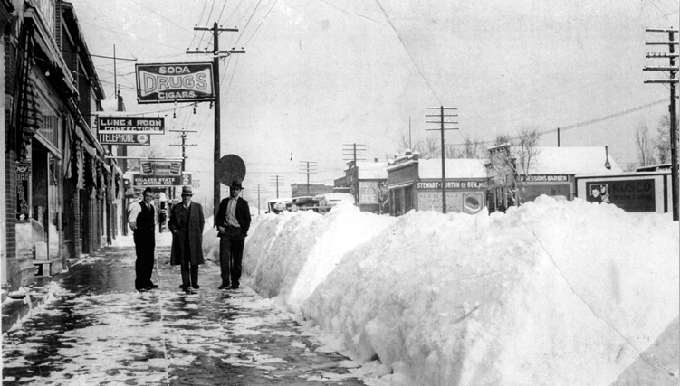
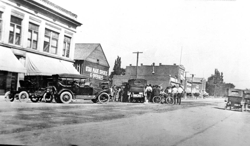 Circa 1920-30’s. Imagine this without cars… and fewer buildings.
1854 Town Plat Surveyed
In 1854, Jesse W. Fox, LDS Church surveyor produced a town plat
containing 12 blocks with east-west numbering, 6 blocks with north south orientation named after trees; 7th Street became Main Street.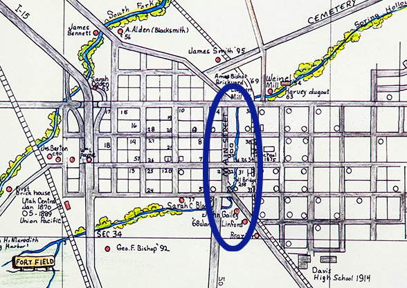
It has been said that water controls the history of the West. Through these blocks ran a life-giving spring-fed stream, the source for which did not come from the mountains as was the usual case. Spring Hollow Creek had steep banks along most of its length. Running year-round it flowed southwest parallel to Cemetery Road, crossed Cherry Street (200 North) and ran along the east side of what was to become Main Street until about Maple Street (100 South) where it turned west (BS ppt) Toll bridge.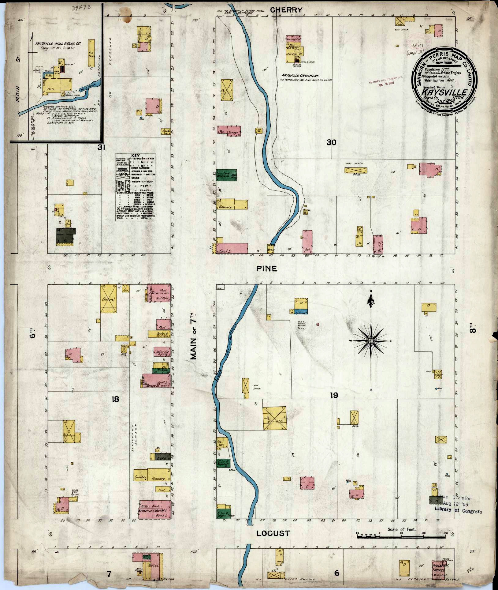
1894 Fireman’s Insurance Map – Library of Congress (external Link)
1944 Modernizing & Remodeling
From there and back again is one theme of the history of Kaysville. In 1944, members of the business community were anxious to present a modern face to visitors. As a result of that concern, the second story of many buildings were removed, and the fronts spruced up. This concern was instigated by a new development on the west side of Main Street begun by Ray Ashton. About forty years later a redevelopment agency was formed in 1980 because of the “eroding downtown business district” with federal block grant funding. A fire on April 1st of 1983 “spurred the recent redevelopment. The Layton and Sanders buildings took on a new look as they were remodeled “to resemble turn-of-the century type architecture.” (Lakeside) The Weekly Reflex printed an article in 1922, boasting of Chamber of Commerce “where men and women are admitted on equal terms.” The 19th Amendment had recently passed, and citizens strove for equality and progress, a work that continues in 2020. The club’s president was W. P. Epperson, Mrs. J. W. Thornley, vice president, and H. L. Gleason, secretary.
104 North Main Street
Begin at about 100 North on the east side of Main Street and continue walking south until you reach about 33 South Main Street.
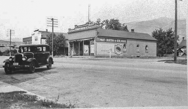
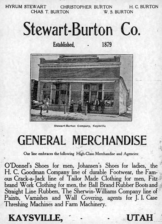
The Stewart – Burton Mercantile Store
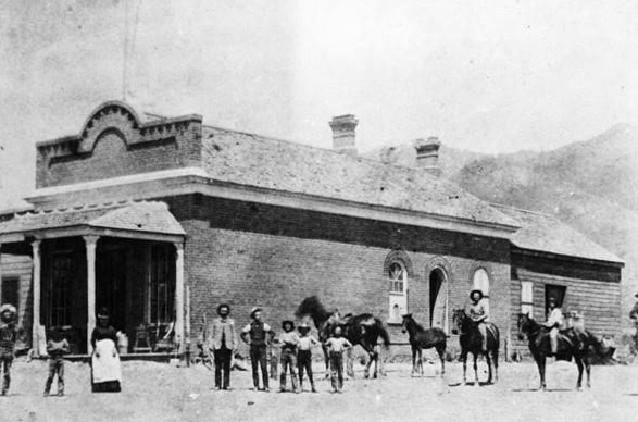
On the northeast corner of 1st North and Main (7th and Pine) stood a store first built by Christopher Layton. It was started in about 1870.
It was sold in 1879 to Charles and Hyrum Stewart to became known at “Stewart Brothers.” Charles Tingey purchased a portion of the interest of Christopher Burton after the death of Charles Stewart. Hyrum, in turn, took his nephew, Christopher Burton who was only 14 years old, into the firm. It then became known as “Stewart-Burton Company,” and lasted under that organization until the [early]1930s when it was closed for business.
After the death of Hyrum, Christopher Burton had sole management. The Stewart-Burton enterprise carried all types of goods, from hardware to shoes, medicine and toys. The 1884 store specialized in dry goods, especially clothing items. It also sold paint, hardware, coal and groceries, and was a dealer in large farm machinery. A 1922 article stated that the proprietor “. … retains the patronage of its old-time customers and has added many new ones.” (Prosperous) A small grilled window on south side of store served as the town postal service from 1879-1890 with Hyrum Stewart as postmaster.
Davis Farm Co-op / Thompson Marine / Bob Spiers Plumbing / Cabinetry Shops
Where the Stewart-Burton Store once stood, the Davis Farm Co-op was the resident business during the 1960s. A farm co-op has been active in Kaysville since the early years. Farmers purchased gas and equipment while having an outlet for some of their products. By banding together, they were able to succeed far longer than on their own.
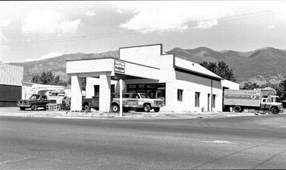 Spiers Plumbing. July 1978 (Anderson)
This shop became the site of Thompson’s Boat and Marine after Davis Farm Co-op moved further north to a new building. They were in business in the late 1960s to mid-1970s.
Bob Spiers Plumbing moved to the northeast corner of 1st North and Main in the 1970s when the boat store closed. He stayed about ten years until his store
moved north to 412 Market Street.
Lewis Ice Cream Parlor
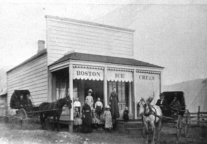 Pictured are Horace Lewis’s brothers and sisters
with mother Mary Ann Phillips Lewis.
In 1880 Thomas and Mary Ann Lewis move to her hometown; he was a carpenter and builds a shop for his wife on the southeast corner of Main and 1st North. The Lewis Sisters Ice Cream Parlor opened by at least 1888 by Mary Ann Phillips Lewis. Also known as the Lewis Ice Cream Parlor, it featured “Boston Ice Cream.” Mrs. Lewis also sold her homemade pies, cookies & cakes. Local candy treats made by various Kaysville candy makers were available to meet Kaysville resident’s sweet tooth. Boston ice cream was her specialty, along with candy made by the daughter Eloise Lewis Burton.
A fun note is that a future governor, Henry H. Blood, did the freezing of the ice cream. From small beginnings in a small-town atmosphere came one of Utah’s governors, a man who guided the state through the Great Depression.
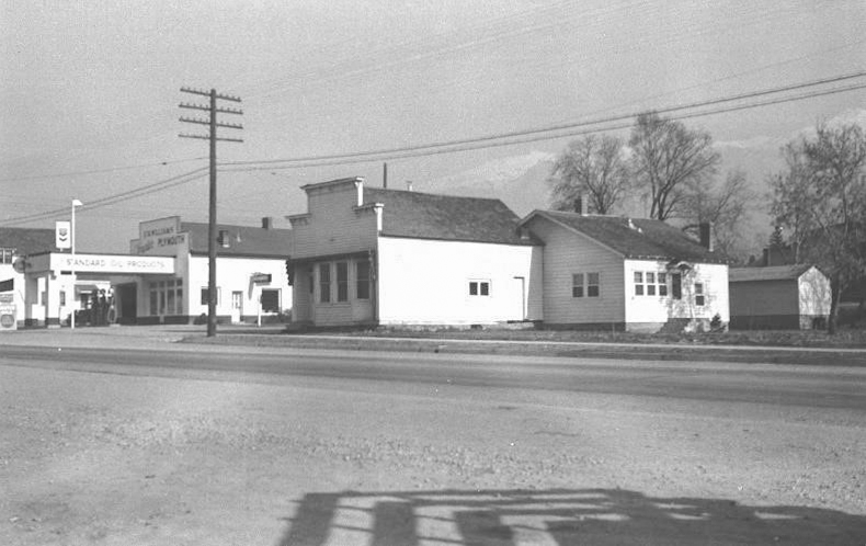 Jed Sessions Barber Shop and home in forefront.
Chrysler & Plymouth Dealer north in old Stewart building
This prime frontage property was purchased by the city in 1941. All structures on the east side including the Lewis buildings, Tommy’s place, and the nearby Gailey dwelling were sold to the city at this time.
Horace E. Lewis Photography / Jed Sessions Barber Shop / Sherner Café / Preece Shoe Repair
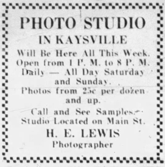
Horace Lewis was a major Davis County photographer. He had a portable photo wagon which he used for location photography. His studio/darkroom was situated in the back of the Lewis Ice Cream Parlor which had been his mother Mary Ann Lewis’s enterprise for many years after his father’s death in 1886. Lewis built a house behind and east of the shop. Many local studio portraits of Kaysville individuals and families were taken by Lewis.
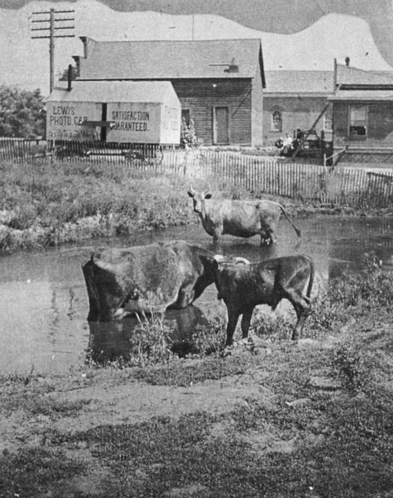
Spring Hollow Creek ran along the east side of Main Street passed the Lewis Shop. Grazing cattle tied alongside the streams, creeks and irrigation ditches was not an unusual sight in Kaysville well into the 1900s. In some places, the banks were quite deep. A 1901 Poll tax was issued as the citizens employed taxes to fill up the hollow “on the Lewis place.”
In 1921, Lewis closed his photo gallery and Jed Sessions opened a barber shop. The barber and beauty shop catered to both men and women, flapper hairstyles and waves being the fashion. The news in the papers of 1922 was that Sessions was an “old time barber” who kept up “his end of the tonsorial game at his new shop.” (Prosperous)
After Sessions moved to Salt Lake City, J.H. Preece opened a “modern shoe rebuilding shop” with the “latest electric equipment installed.” (Reflex) Sherner Café moved in next, just a few years later in 1932; it was run by Mrs. Mark Sherner. The buildings were sold in 1941 to J.W. Webster and W.D.
Barnes.
Co-op Lumber Yard / Blacksmith Shops / Tommy’s Café
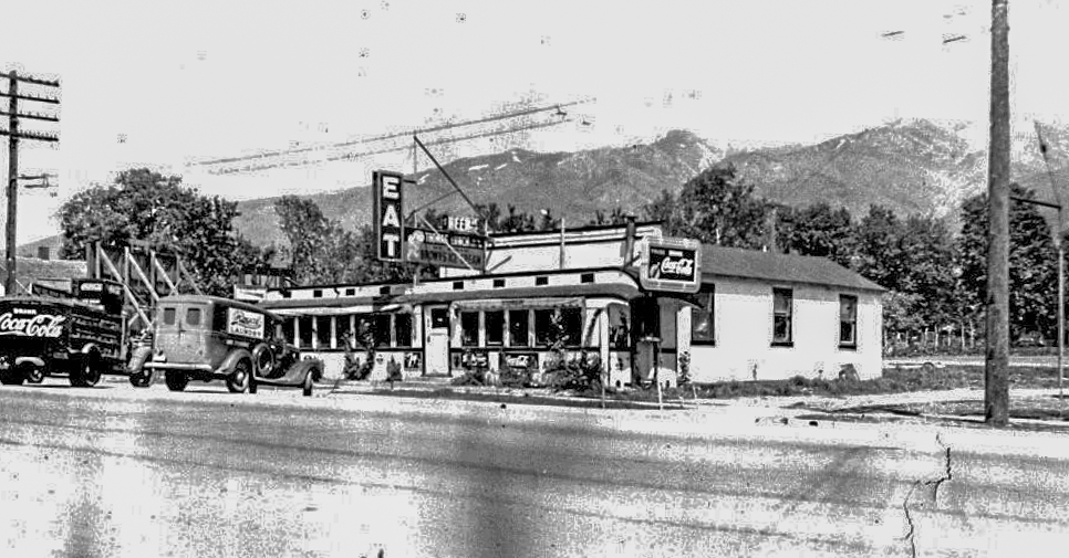
This building was crafted from a discarded Southern Pacific Railroad passenger car. The proprietor of the café was Howard Thomas. Thomas also had a restaurant at Farmington Crossroads (Cherry Hill now in Fruit Heights;) both were named Tommy’s Cafe’, a.k.a. Tommy’s Place. The café was in business from 1934 to 1941. A year before it closed, pool tables were installed.
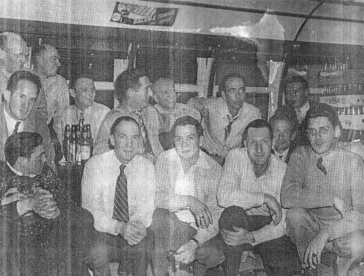 Volunteer Firemen. ca. 1940.
Howard Thomas, third from right back row
The book Kaysville, Our Town states that the Co-op Lumber Yard was at 47 North Main prior to Tommy’s Café. North of the café there were two blacksmith shops close to each other. One was sold in 1941 and could have been the one that belonged to either N. K. Nelson or Charles E. Wilson.
First Reflex Building / Pool Hall / Barbershop
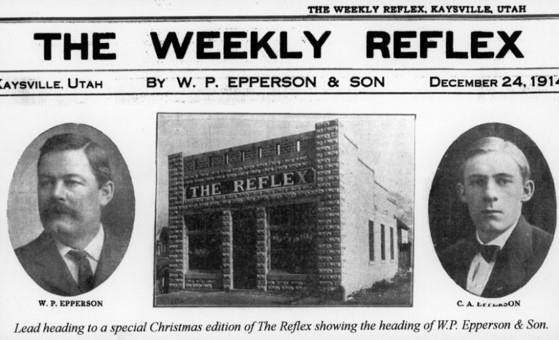
About halfway down the block you will see where the old Weekly Reflex building was located at 30 North on the east side. It was established in 1910 by John S. White. White had edited the Davis Co. Argus newspaper.
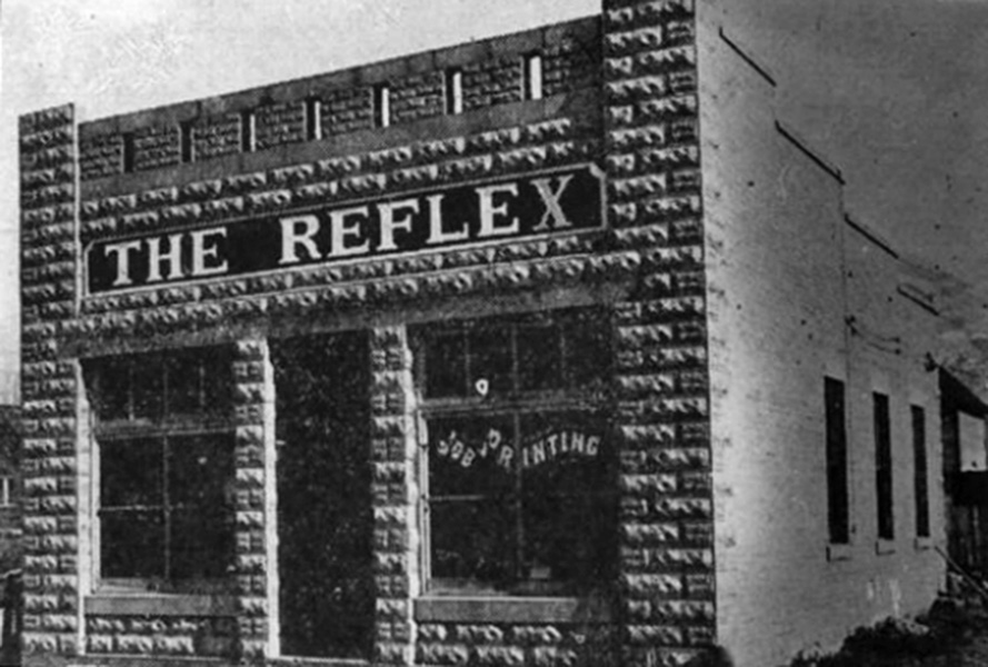 Original Reflex Printing Company ca. 1915
address was 30 North Main
Epperson bought this building and started the Weekly Reflex in 1912. The Epperson family ran the paper from 1912 to 1955. He moved the newspaper and printing business to the Egbert building shortly after purchasing.
The Inland Printing Company was incorporated in 1919. It printed The Reflex which was a nationally recognized weekly newspaper winning five different national newspaper awards. The paper moved to the site of the Egbert Hotel at 4 So. Main the year of incorporation. In By 1922, J. H. Hansen was conducting a barbershop and pool hall in the building formerly occupied by Inland Printing. Company.
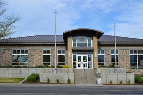
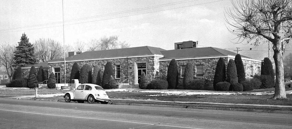
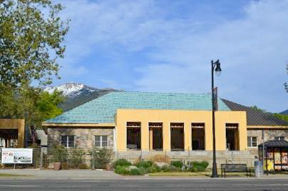
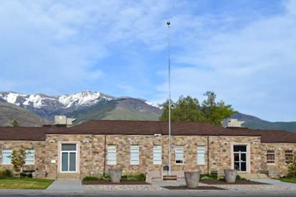 Rock building was the site of city hall, the city library and the county health center and is now on the National Register of historic buildings. Address is 44 North Main.
Texaco Service Station
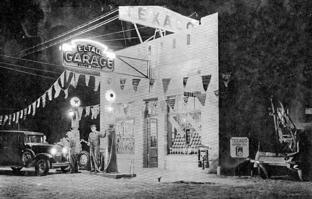 In 1924, Earl L. Tall’s first garage moves into the old Reflex building which was painted white. In 1929, the building was leased to the gas company, but Tall’s Garage moves back in 1934.
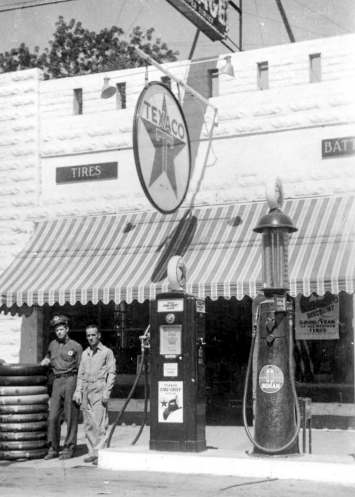 Notice both an old and new style gas pump spanning the 1920s and 30s
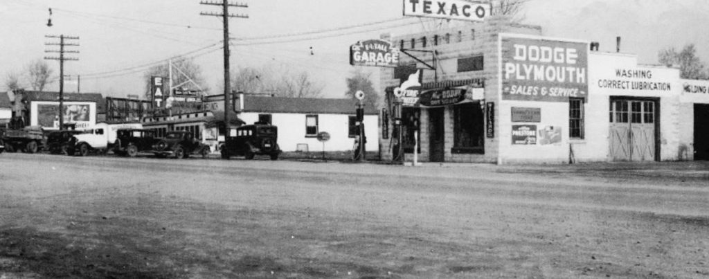 Texaco ca. 1936. Notice the railroad car café down the street. The pool tables were in the white building behind the café.
Shell Service Station/ Live Nativity / New City Hall /City Hall Remodeled
 Jesse Thornley’s Shell Station. ca. 1929
By 1929, “cars were more common and gas stations were needed.” Jesse Thornley opened his Shell Station where the coal yard had been (Shadow)
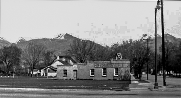 Open grass where Christmas stable scene was set up. ca. 1943
In 1943, several structures were removed to make way for the then-new Kaysville City Hall building, now known as the historic rock building. A live nativity tableau was set up on the lawn in the open space on the northeast corner of Center Street and Main. For a number of years, a Bethlehem Stable scene, sponsored by the Kaysville Civic Association with help from the Kaysville Jaycees, the Lion’s Club and the American Legion was set up at Christmastime. Real sheep and donkeys were penned at the site.
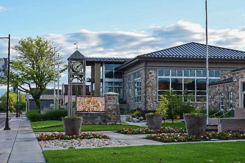
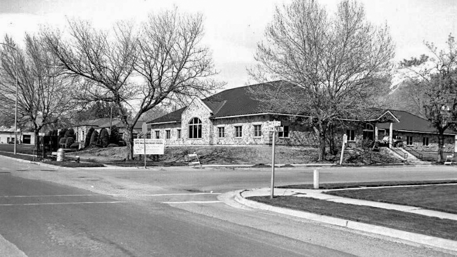 The “New” City Hall, June 1986. (Anderson)
Interior Block Center
Egbert Barn and Stables / Johnson Hotel/ Brigance Paint / Conoco Service
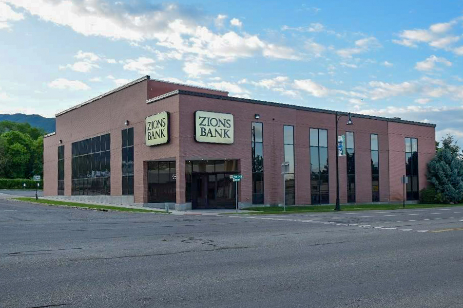
Where Zions Bank now stands was once the horse barn and stables used by the Egbert Hotel (The hotel was situated directly west across Main Street) Later, this was the site of the Johnson House Hotel and still later a Conoco Service Station.
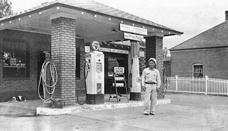 Frank Berry’s Conoco Service. 1931
When this Conoco Service station was built in 1931; the claim was made that the building was the first of its design in Utah. W. B. Muir was the manager. From 1932-1945 several different managers or operators were in charge with Delbert Pilcher managing from 1945-1949. Howard Cloward opened his Howard’s Conoco in 1950. In the spring of 1957, a brand-new station was constructed behind the old building so they could stay in business until the new one opened.
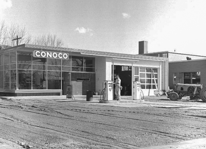 New Conoco after old building in front was removed
Howard continued operating the station until about 1970.
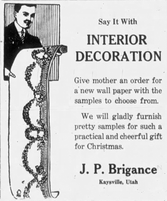
The first of many businesses on this site was installed in 1900. Lewis M. Link built a one-story saloon, but was killed in a barfight in Castledale, Utah the following year. Edward Davis then bought the structure and converted it to the Edward Davis Restaurant, but that only lasted a couple of years. In 1903, Kerby Sims purchased and established K. S. Sims Confectionery. This business was more successful, but five years later Sims moved his business west across the street and took over the old Egbert Hotel. The building was then sold to Dr. J. E. Morton for an office and residence. Dr. Morton erected the second-floor addition. In 1910 William, and Charlotte Johnson take over and set up as Johnson House Hotel. When Charlotte died in 1915, William desired to move back to Belgium; eventually Mrs. E. P. Epperson purchased so he was able to return. J. P. Brigance Paint and Wallpaper store were in the building until Berry’s Conoco was constructed.
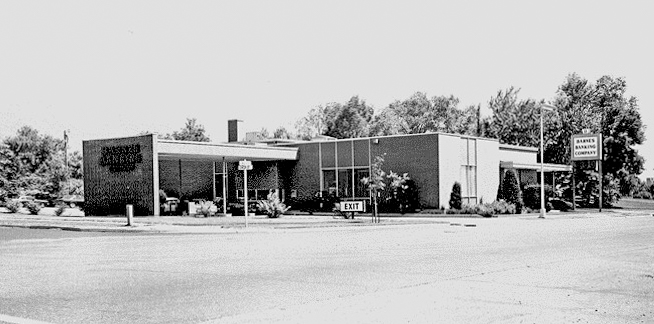
Barnes Banking Company
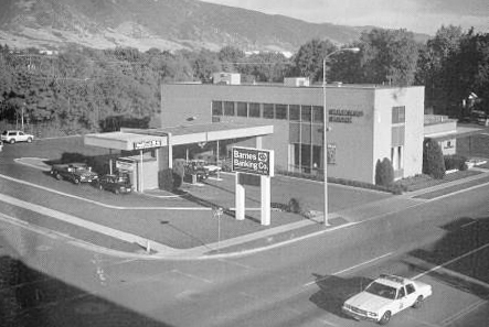 Barnes Bank Building. ca. 1975
(from Barnes Bank advertising calendar)
In December of 1956 construction began on a new, modern Barnes Bank building kitty corner southeast from the old site in the Barnes Block building. Several small shops were torn down in the process. (see ads below)
Grand Opening Saturday October 5, 1957. Architects were Ashton, Evans & Brazier. The cost to build $125,000. Federal and State Regulators shut down Barnes Bank and all its 10 branches on Friday January 15, 2010, the bank having failed the prior year. They allotted a 30-day transition for people to transfer money elsewhere. Its closure was quite a shock for many citizens who had seen the establishment as a fixed entity in the financial center of the community. The building was later taken over by Zions Bank which currently in 2020 is still in occupancy.
Electric and Shoe Shops / Café 91/ Bank Parking Lot
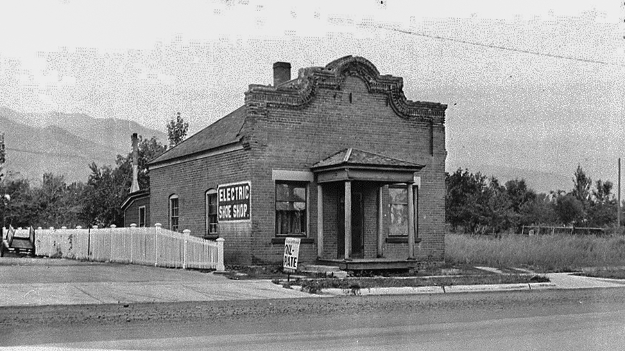 Electric & Shoe Shop. ca. 1922.
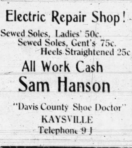
South of the bank in the parking lot is the location of the former 91 Café, a popular eating place for many years. Before the café, however, a shoe shop and electric repairs shop stood from 1918-1940. (Prosperous 1922 – William Lavendar “ looks after the wants of people who are in need of shoe repair. Mr. Lavendar is not only a good workman but has plenty of power-driven machinery which cannot be excelled for its purpose. 1908-1918 Hanson Shoe Shop, Sam Hanson owner he moved business to Salt Lake / 1918-1940 Lavender Shoe Shop, John Lavender from 1918 to his death in 1930, then son Ray took over until 1940 when he moved the shop to Layton. (about 33 South now)
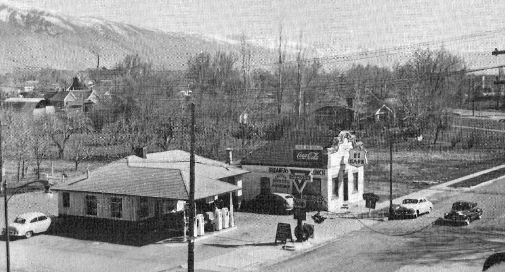 Café 91business. ca. 1941 (Anderson)
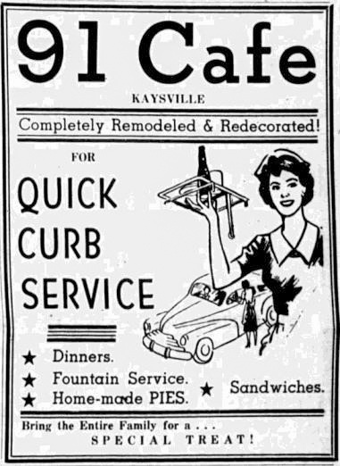
Then the building was remodeled into the 91 Café. 91 CAFE (1941-1954) 1941 Grand Opening Saturday May 10, 1941 ( Ad)
Owner of the building was Weldon Hayes (FYI in 1941 he also managed the Conoco at that time) / 1942-1954 Several proprietors over the years including Jim and Mina Webster, Thelma and Ross Williams, Frank Hamilton, Al E. Peterson. / 1954 January the business was for sale by the owner Weldon Hayes. Weldon died in December of 1955.
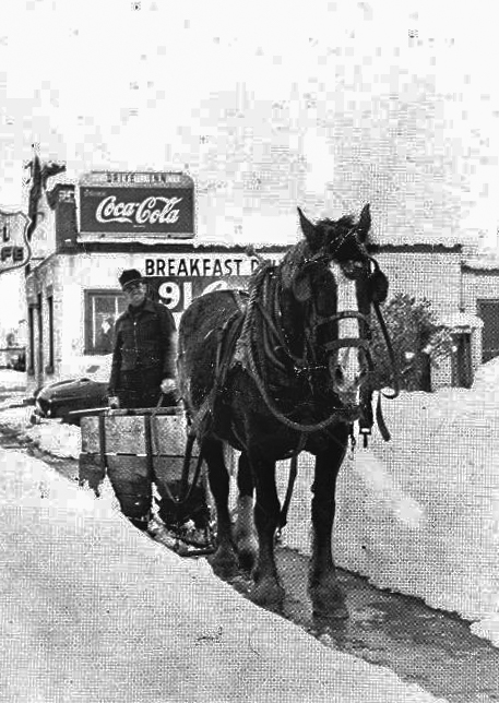
The next year 1956 torn down to build Barnes Bank By that time Main Street was a part of Highway 91.] [Shadow 42 “Man plowing is Lyman Blood. For years, he was the unofficial custodian of Main Street, cleaning the business windows, and keeping sidewalks clean, a friend to all.”] 1947 (Anderson). [1953 Telephone Book – 91 Café 17 South Main Street] Punch boards and juke box
Sources and Credits:
1. Kaysville and Layton General Stores. 1987. Doneta Gatherum and Kent Day. Kaysville-Layton Historical Society.
2. Sanders, Bill. “Main Street: Kaysville’s Avenue of Commerce” slideshow.
3. “Autobiography of Sarah B. Layton.” Printed in serial format in the Woman’s Exponent.
4. Pioneer Women of Faith and Fortitude vol. 1-4 p. 1742. International Society of Daughters of Utah Pioneers.
5. Preece, Norma. Article on “Main Street.” Davis Reflex Journal
6. In the Shadow of Ed’s Peak: A Pictorial Essay of early Kaysville / Fruit Heights compiled by the Kaysville – Fruit Heights Centennial Committee 1996
7. Kaysville Historic Tour (Then and Now). Linda Ross. 2008.
8. Collett, Carole I. “Main Street.” Kaysville, Our Town.
9. Mountain States Telephone and Telegraph Company. Fall 1953 Telephone Book. Paulette Robins Bennett Collection.
10. 1960 Telephone Directory and Yellow Pages.
10. Map on page 3 left: Portion of Kaysville map produced by Kaysville – Fruit Heights Utah Centennial Committee. 1995.
11. Map on page 3 right: Fireman’s Insurance Map 1894. Accessed on Library of Congress.
12. Photographs from Kaysville – Fruit Heights Museum collections including those of Bob Anderson and Linda Ross.
13. Photographs from Heritage Museum of Layton.
14. Lakeside article by Norma Preece. Davis Reflex Journal article by Norma Preece. Both 1985.
15. “Kaysville the Site of a Prosperous Little City and Its Doings for the Past Year.” Weekly Reflex. Dec 22, 1992. Pages 1, 4.
16. Photographs by Kurt Falkner for current locations. 2020
17. Davis County Clipper, Salt Lake Tribune and Woman’s Exponent Articles.
18. A Brief History of the Kaysville and Layton Post Offices. 2nd Edition. Kaysville – Layton Historical Society. 1986.
19. Malan, Ruth. “Appearance of Kaysville Changing.” Lakeside Review.
